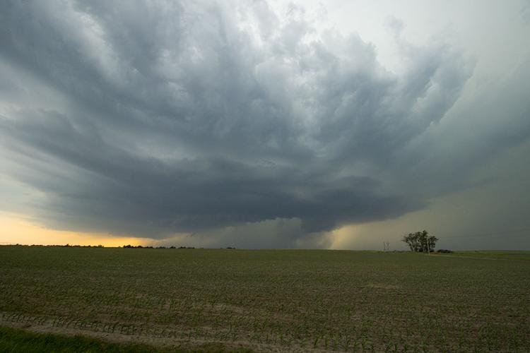
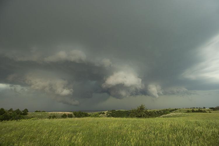
The tornado warned supercell as the RFD created the horseshoe shape I have been taught to look for. Soon after the storm produced a brief and weak tornado. It was several miles north of Brady at this point.
C-H photo • Brian Neben
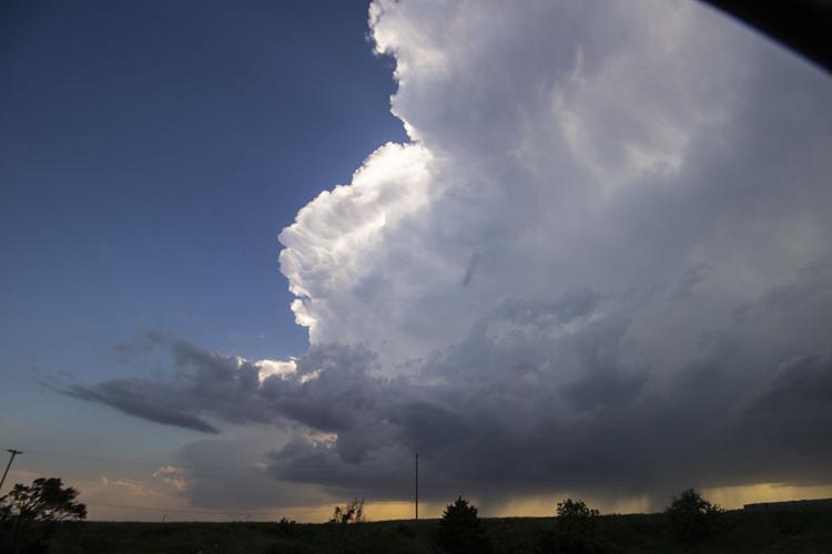
The birth of a tornadic supercell. Several storms were firing in Lincoln County and began to organize.
C-H photo • Brian Neben
The wall cloud being produced by the developing supercell immediately caught my attention and drew me closer.
C-H photo • Brian Neben
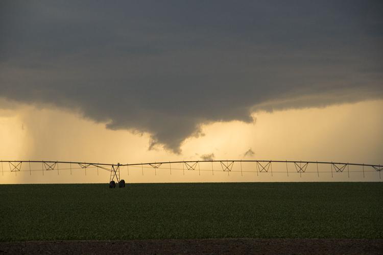
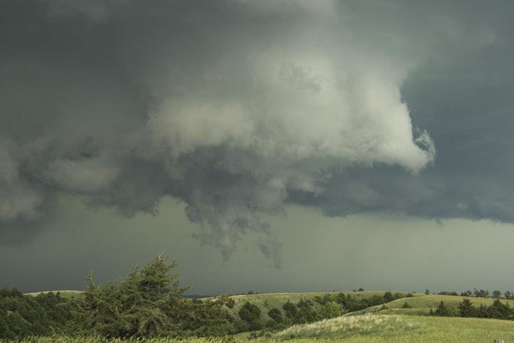
While difficult to see, the dust in the foreground being lofted into the air under the wall cloud was later confirmed to be a tornado. This is the third one I have witnessed as a storm chaser.
C-H photo • Brian Neben
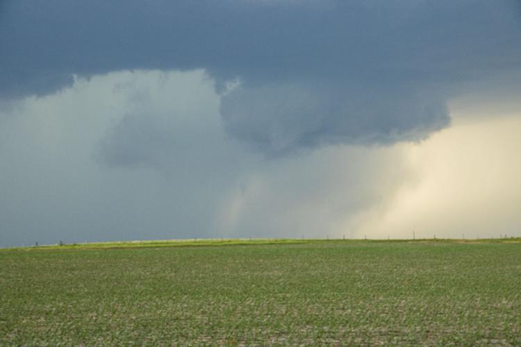
A number of low hanging clouds formed around the base of the mesocyclone as the cyclical supercell cycled once again, it would do this several times during its lifespan.
C-H photo • Brian Neben
While low hanging from the storm's base, these clouds were scud and not tornadic. For a moment I might see a fully condensed funnel, but it was not to be at this point.
C-H photo • Brian Neben
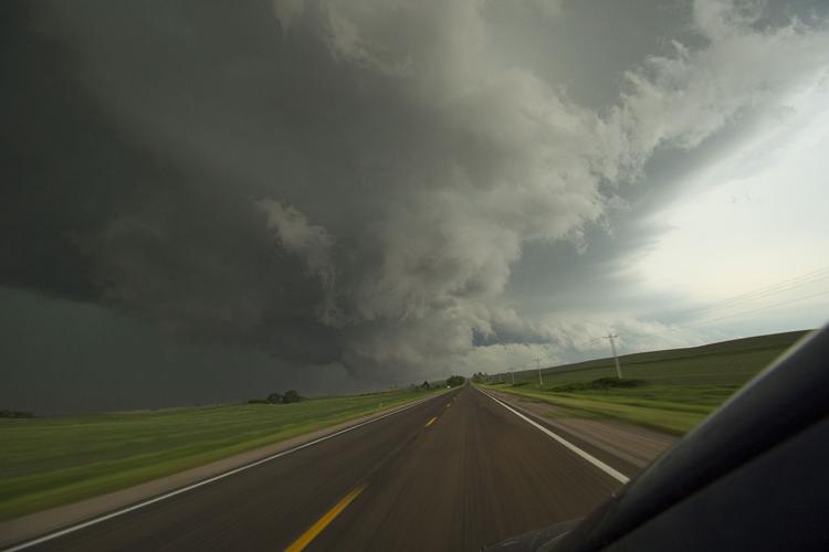
This shot will likely go down as my favorite of 2020. A wall cloud was beginning to take shape as the storm approached Arnold, but I didn't want to pull over to photograph it. With a free hand I wrapped the camera strap around my arm and held it out the window and snapped the photo.
C-H photo • Brian Neben
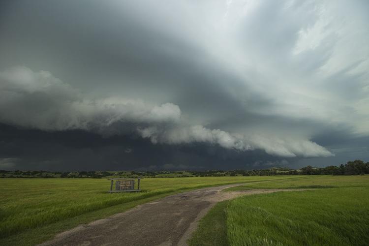
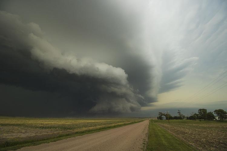
The gust front of the rear flank downdraft of the supercell rolls across the floor of a valley in Custer County.
C-H photo • Brian Neben
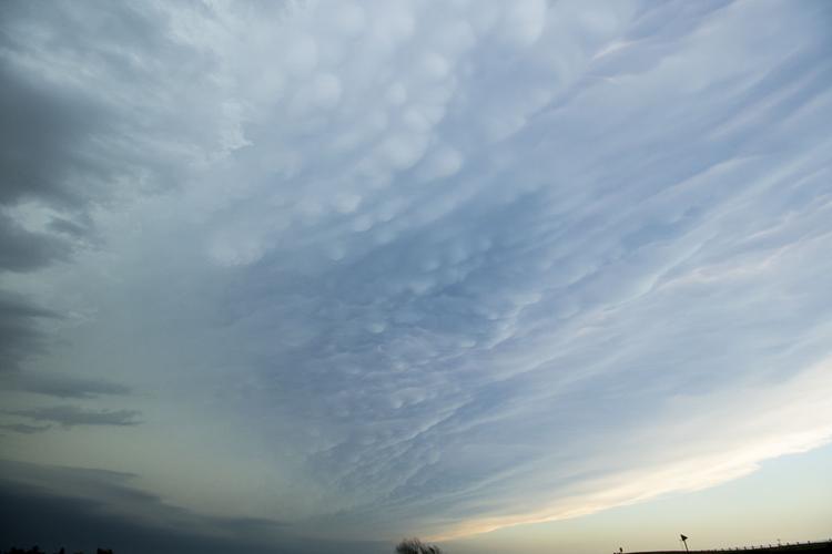
Looking almost straight up, mammantus clouds were forming on the bottom side of the anvil of the storm.
C-H photo • Brian Neben
The storm organized afresh and a new wall cloud appeared as the gust front neared my location. My video was able to see a small funnel in the depths of the storm.
The tornado warned supercell as the RFD created the horseshoe shape I have been taught to look for. Soon after the storm produced a brief and weak tornado. It was several miles north of Brady at this point.
While difficult to see, the dust in the foreground being lofted into the air under the wall cloud was later confirmed to be a tornado. This is the third one I have witnessed as a storm chaser.
A number of low hanging clouds formed around the base of the mesocyclone as the cyclical supercell cycled once again, it would do this several times during its lifespan.
While low hanging from the storm's base, these clouds were scud and not tornadic. For a moment I might see a fully condensed funnel, but it was not to be at this point.
This shot will likely go down as my favorite of 2020. A wall cloud was beginning to take shape as the storm approached Arnold, but I didn't want to pull over to photograph it. With a free hand I wrapped the camera strap around my arm and held it out the window and snapped the photo.
The storm organized afresh and a new wall cloud appeared as the gust front neared my location. My video was able to see a small funnel in the depths of the storm.