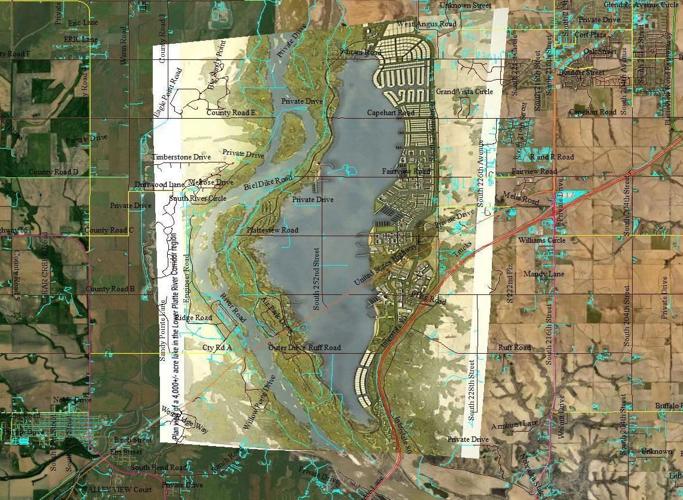
This image produced by Larry Stolzer of Springfield shows an overlay of an artist's rendering of a potential lake between Lincoln and Omaha and where the body of water could possibly be situated between Interstate 80 and the Platte River between Gretna (top right) and Ashland (bottom left).
The distinctive curve of the Platte River in an artist's imagining of what a 7-mile-long lake between Lincoln and Omaha would look like was a good clue.
This preliminary rendering shows the potential for economic development adjacent to a proposed 4,000-acre lake between Lincoln and Omaha. The proposal awaits a feasibility study to consider its potential impact on the future water supply for Lincoln and Omaha.
This image produced by Larry Stolzer of Springfield shows an overlay of an artist's rendering of a potential lake between Lincoln and Omaha and where the body of water could possibly be situated between Interstate 80 and the Platte River between Gretna (top right) and Ashland (bottom left).
This preliminary rendering shows the potential for economic development adjacent to a proposed 4,000-acre lake between Lincoln and Omaha. The proposal awaits a feasibility study to consider its potential impact on the future water supply for Lincoln and Omaha.